
Mobile mapping
Support the creation of Smart City
What is mobile mapping?
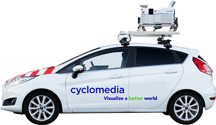
Mobile mapping involves acquiring spatial data from street level via a vehicle with a sensor mounted on its roof. This results in the acquisition of high-resolution 360° panoramic images and LiDAR data, which preserves the metricity of the acquired data and the possibility of further analysis, e.g., for object detection.
Main target group
The recipients of the mobile mapping data are municipal offices in densely urbanized, large metropolitan areas and localities that have at least 250 kilometers of roads within their boundaries. It will add the most value to the daily work of the departments of Smart City, development, planning, architecture, urban planning, promotion, tourism, information technology and many others.
What differentiates us?
We are the only authorized partner of Cyclomedia, which provides this solution with a dedicated browser with implemented tools for working on mobile data.
The data presented is metric, which allows precise measurements with a standard deviation of up to 10 cm.
We provide the ability to integrate mobile data with other spatial data such as orthophotos, oblique images, LiDAR point clouds or vector data.
Technology used and features of mobile mapping
Panoramic imagery
High-resolution images – acquisition and processing of high-resolution panoramic images of the entire public space in the designated area provides high-quality starting material for conducting spatial analysis. This is particularly important in developed agglomerations, for which the disposal of public space in accordance with the idea of Smart City is becoming a priority.
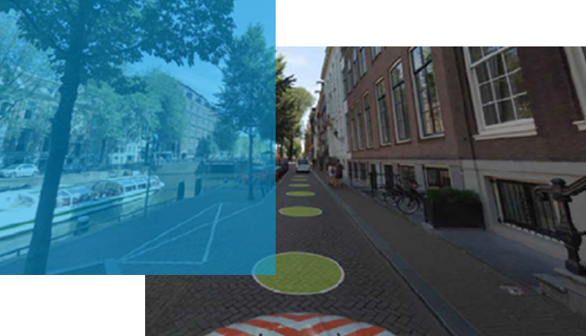
Mobile recording system – all data is acquired using a fleet of cars adapted for recording images from a street perspective. Each of them has been equipped with five independent cameras, a LiDAR scanning system, an IMU system and a GPS antenna. Using these technologies, high-quality metric data is acquired.
Technical details:
Frequency and precision – high quality images recorded every 5 meters on all public roads accessible by cars, and their distance measurement error defined by relative measurement accuracy is 2 cm.
Insensitive to weather – no negative impact of the sun on the quality of images and a guarantee of visibility of objects even in shaded areas in parallax-free images.
Metric accuracy – registered images are characterized by the accuracy of the location of all registered objects with an average standard deviation of 10 cm in all directions.
High resolution – to guarantee excellent visibility of even the smallest objects, images are captured at 100 MPx (14,400 x 7,200 px) resolution.
LiDAR point cloud
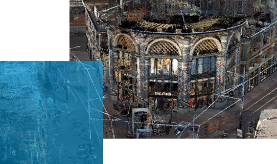
Third dimension – an additional dimension added to panoramic images, taking into account 3D perspective. Location, distance and ground surface measurements become possible with a single click. High accuracy of the point cloud thanks to the acquisition of millions of points in RGB colors. Each point contains an assigned color attribute, assigned on the basis of panoramic images.
Simultaneous registration – LiDAR data registered during the process of acquiring panoramic images. This eliminates the need for additional measurements.
Technical details:
Velodyne HDL-32E scanner – the recording system operates at 700,000 bounces per second, and the maximum distance from the recorded object is 70 m.
Downloadability – availability of data in LAZ format for downloading in a 50×50 m grid.
Freedom of display – the ability to customize the point cloud display parameters according to the user’s needs, including the number of points, point size, edges or color intensity.
Any coordinate system – the LiDAR point cloud and corresponding images are delivered in the reference system selected by the customer.
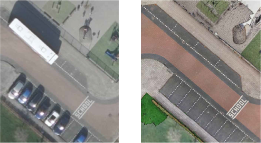
On the left is an aerial photo, on the right StreetOrtho.
Advanced analitycs
StreetOrtho – an orthophoto made based on high-resolution panoramic images and LiDAR data acquired from mobile mapping systems placed on cars. Unlike traditional ortho images, StreetOrtho allows the removal of objects that may block the view, i.e., treetops or protruding roofs.
Surface type mapping – additional detailed analyses performed based on panoramic imagery, LiDAR and StreetOrtho. Additional analyses take place after individual arrangements with the client and can cover many aspects of urban space.
The list of additional analyses and services includes:
mapping of surface types,
detection of urban lighting,
detection of traffic signals,
detection of vertical and horizontal road markings,
detection of billboards and advertisements,
detection of road surface condition.
Dedicated browser
Access geospatial data – gain access to geodata of any kind with an interactive web application. The dedicated system is designed to share, view and work on spatial data acquired through the mobile mapping service from a street perspective.
Advanced tools – built-in tools allow the user to easily view data and analyze and make measurements based on the spatial data modules provided in the system. The browser’s multitude of functions definitely improves the work of planning any investment in public space.
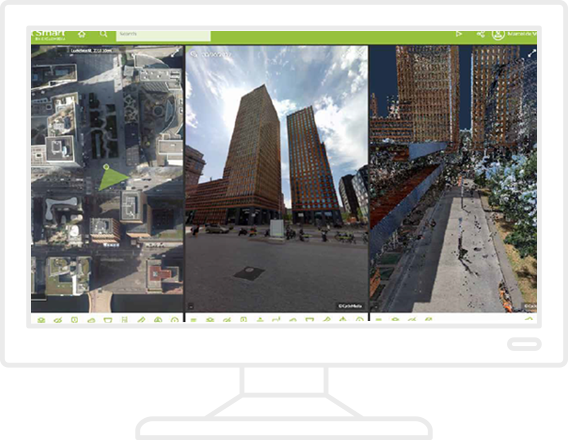
Technical details:
Extensive functions – measurement, layer overview, elevation, report generation and export, information search, historical data.
Easy implementation – no maintenance work on the part of the ordering party, thanks to the use of the contractor’s servers to provide the service.
Universal language – system built on HTML5, compatible with all the most popular web browsers.
Mobile devices – the ability to view data anywhere, thanks to the mobile application, supported by mobile devices with the most popular operating systems.
Implementation benefits
The ability to take precise measurements without leaving the office.
Analyzing space from a resident’s perspective with the ability to quickly detect problems and needs
Better prioritization of road repairs through efficient acquisition of data on the type of cavities and the cavities present through a single pass.
Taking care of architectural integrity through billboard detection and analysis.
Possibility for the authority to rent a vehicle with a sensor for its own needs.
More about 360° perspective
Hybrid aerial acquisitions are one of the products from bundle 360° Perspective. You can read more about other products from 360° Perspective here:
Other products
For a more complete demonstration of our activities, we encourage you to take a look at our other products:

OPEGIEKA Sp. z o.o.
Aleja Tysiąclecia 11 82-300 Elbląg
tel. +48 (55) 237 60 00
fax +48 (55) 237 60 01
Facility in Warsaw
ul. Grzybowska 80/82 lok.
700 00-844 Warszawa
