
TreeQuant
Harness the potential of spatial data in forestry
What is TreeQuant?
A platform that provides access to the latest and archival publicly available remote sensing data, along with the ability to integrate with other spatial data. The repository contains modules dedicated to specific forest management tasks, including forest resource inventory. It provides tools to facilitate forestry work.
Main target group
The main recipients are Polish forest districts and their foreign counterparts, which have tasks directly related to forest management in their scope of responsibilities.
What differentiates us?
Because OPEGIEKA has held the status of a research and development center invariably since 2013, we were able to obtain funding to conduct a research project called „TreeQuant – Development of a self-learning IT analytical platform to support the forest management process based on image data from photogrammetric cameras and point clouds of a multi-spectral laser scanner.” Read more about the project here.
Thanks to this project we have developed data processing methodologies that allow us to provide better final products, such as maps of taxonomic features, with high precision, which translates into lower estimation error.
Technology used
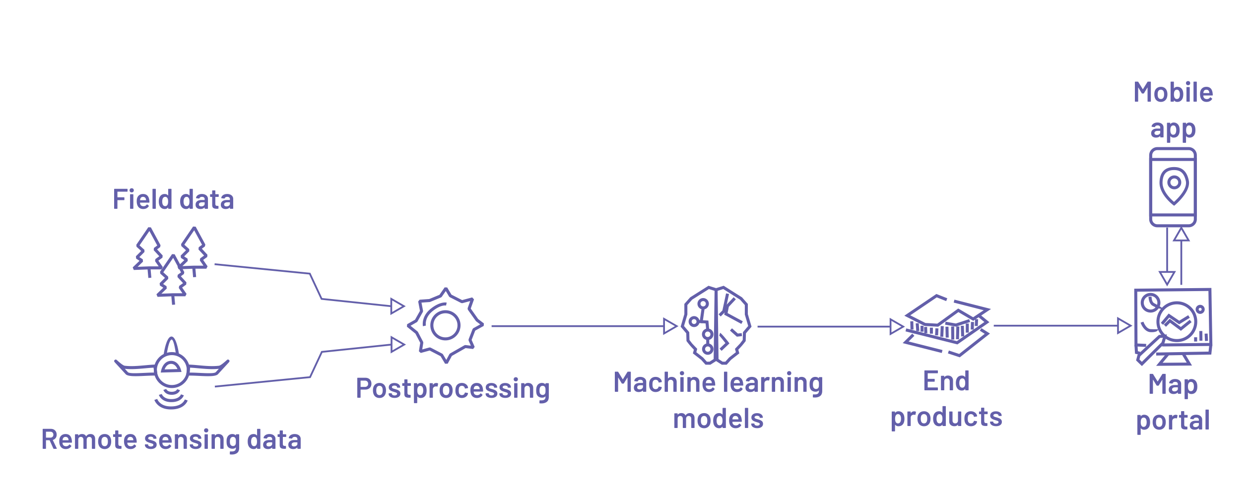
We use advanced machine learning methods in data analysis. This approach allows us to obtain more complete and accurate information on forest stands.
Funcionalities
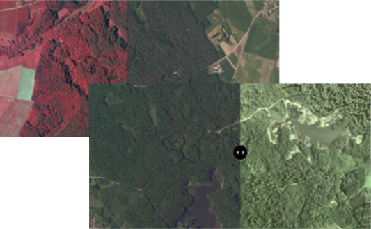
Viewing multi-temporal orthophotos
Resources of the forest district and GUGiK (Polish Central Office of Geodesy and Cartography) – access to orthophotos collected in the resources of the forest district, together with orthophotos from the State Geodetic and Cartographic Resources through a single public platform.
CIR and RGB compositions – the ability to change color compositions according to preferences, without the need for specialized tools for working on raster data.
Archived and current data – view archived and current orthophotos simultaneously in a single window. The function allows a quick comparative analysis of changes that occurred during the analyzed period.
Modeling of forest stand characteristics
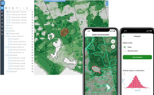
Taxation feature modeling – using machine learning methods and ALS data, we model abundance, stocking, average breast height, density and top height. Functionality requires the provision of processed measurements from sample plots acquired under the PUL (Polish Forest Management Plan).
Grid size 20×20 m – features are estimated in a rectangular grid with a mesh size of 20 x 20 meters and averaged to the level of the division.
Zonal statistics – we provide a tool for calculating zonal statistics for user-defined areas, both on the web platform and mobile app.
Stocking estimates – analyses provide access to information that is helpful when performing stocking estimates, among other things.
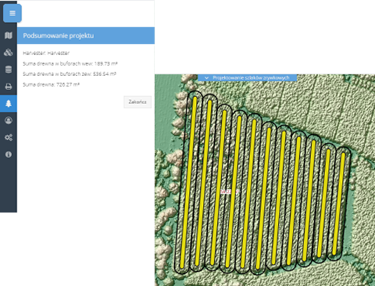
Design of skid trails
Dedicated tool – TreeQuant’s platform provides access to advanced tools to assist in the process of planning the routing of skid trails.
Integration of information – the tool enables the design of trail alignments while calculating the gradients along the route and the estimated timber volume that can be harvested from each trail.
Consideration of constraints – when designing, the tool takes into account constraints such as the width and spacing requirements of operational trails and allowable gradients along the route.
Field verification – the ability to export the design to a mobile app for field verification. The app allows correction of the course of the developed trails, as well as the location of the depot.
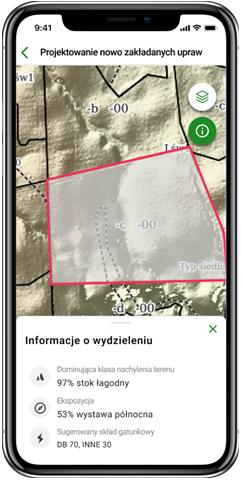
Design of newly established forest crops
Slope and Exposure – information about the dominant slope and exposure class based on NMT analysis for each watershed.
Detailed information – integration with information on habitat type, stand type and species composition from SILP.
High accuracy – the high accuracy of the data makes it possible to indicate microhabitats and accurately map the landform under the canopy of the stand.
Mobile app – access information during field work through a dedicated, integrated mobile application.
Planning for exposure cuts
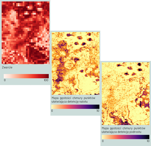
Compaction map – a raster layer of horizontal stand compactness with a spatial resolution of 20 m. It uses information on the percentage of first laser reflections recorded above a certain defined height threshold.
Point cloud density map – providing mapping primers to facilitate the detection of overstory and understory, based on point cloud density at selected height intervals.
New opportunities – an opportunity to optimize the planning of sowing and revegetation cuts by providing information on current stand density and possible undercanopy regeneration cover.
Field verification – the ability to contour and then undergo field verification using a mobile app to determine whether the indicated areas qualify as natural regeneration.
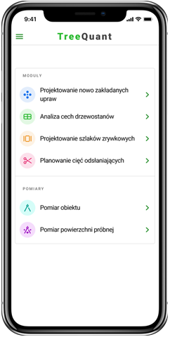
Mobile app
Offline mode – display data in the field, both online and offline.
Site measurement – field option for measuring points, lines and polygons, along with the option to analyze taxation features for selected sites.
Plot measurement – locate circular plots and record tree measurements on sample plots.
Synchronization with repository – option to upload measurement results to map service.
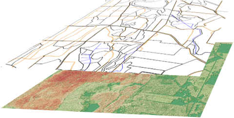
Supported data sets
The repository integrates spatial data from various sources. The basis is raster data collected and made available by GUGiK (and other organizations), such as orthophotos and NMT. The second group consists of derived products, resulting from processing publicly available ALS data. The dataset is also supplemented with vector data from the SILP database, which is provided by the Forestry District.
Vector data:
SILP layers,
forest map templates based on LMN layers,
grid of squares of modeled features of 20×20 m (abundance, stock, top height, average breast height, density).
Raster data:
orthophotos,
elevation crown model,
numerical terrain model,
slope map,
exposure of slopes,
compactness map,
point cloud density maps at selected elevation intervals.
Satellite surveillance
The ability to provide regular monitoring of the forest district area using a series of satellite images transmitted at regular times with a frequency of up to 12 images of the entire area per day with a resolution of up to 50 cm per pixel.
Implementation benefits
Greater control over real timber resources in forest districts.
The ability to download data to a mobile application to make field work independent of Internet access and network resources.
Better planning of the consumption of timber resources and their regular renewal.
Faster response to sudden changes in forest management.
Other products
For a more complete demonstration of our activities, we encourage you to take a look at our other products:
See also – 360° Perspective
A suite of services and products related to spatial data acquisition from any ceiling.

OPEGIEKA Sp. z o.o.
Aleja Tysiąclecia 11 82-300 Elbląg
tel. +48 (55) 237 60 00
fax +48 (55) 237 60 01
Facility in Warsaw
ul. Grzybowska 80/82 lok.
700 00-844 Warszawa
